Solutions
Problems such as the poor timeliness of information, high labor costs, abnormal environment-monitoring requirements, and server room security are the pain points of server room OPS.Once the UbiTrack positioning anchor is set up in the room, the information about the location of staff and important assets is displayed in the control center. The integrated PFID allows for accurate monitoring of staff and assets the target room. With UbiBot's wireless smart sensors, leak detector, and other sensor devices, the staff, hardware, and physical environment in the server room can be monitored in real time.Ensure the safety of your server room and build intelligent and efficient dynamic loop monitoring with UbiBot.

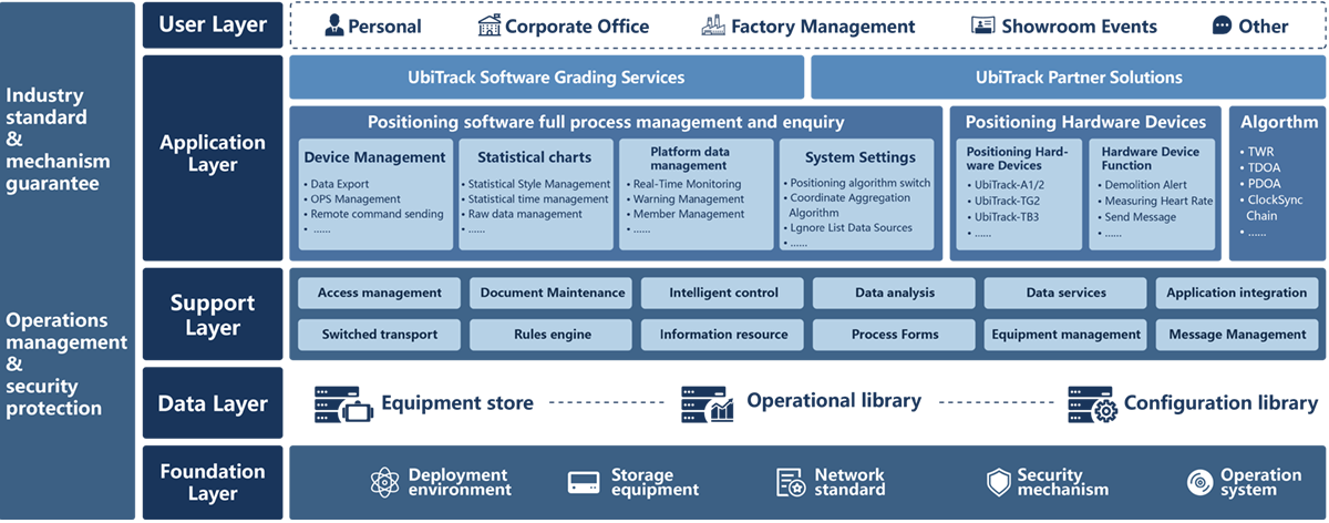
System architecture and principles
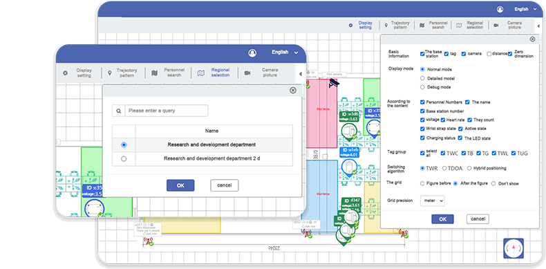
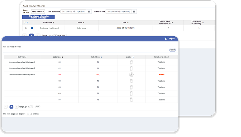
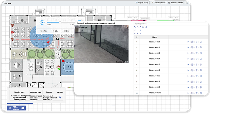
UbiTrack positioning system adopts a number of innovative data analysis and processing algorithms, and a variety of algorithms are hybrid to meet user's different positioning business needs. It has optional spatial positioning (3D),regional positioning (2D),orbital positioning (1D) and other positioning modes. Based on the TWR and TDOA positioning algorithms, the location and surrounding environment information of personnel, vehicles and assets can be accurately located in real time. At the same time, the system also supports track playback, alarm, data interaction, camera linkage and other functions.

The UbiBot platform perfectly integrated intelligent sensing devices and the Internet. Intelligent sensing devices access the platform, collect the target data and transmit it to the UbiTrack platform, where the positioning or environmental data is analyzed and processed. The platform them provides feedback to the user in the relevant form, such as over-limit alarms. The platform can be accessed by mobile phones, computers, and other communication devices.
Product Specifications
Platform Functions
2D View
The anchor is set at the four corners of the area and 2.5 meters higher than the tag, which can make it cover a wider area. The anchor's built-in or external high power and gain omnidirectional antenna, which transmits data through the RJ45 network cable, can reach a maximum speed of 100–500 Mbit/s, the response time is only 0.1 ns. The real-time location data of the tag can be visualized, which allows users to better monitor the position of the tag.
Zone Management
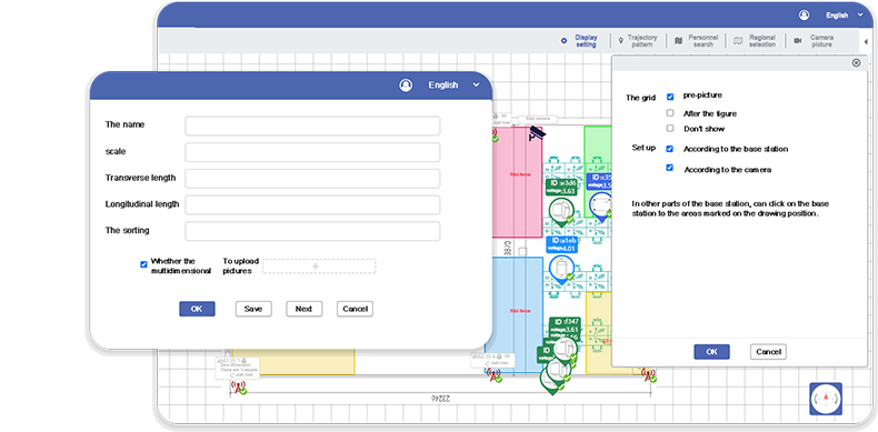
Importing e-maps allows users to quickly build indoor maps on the UbiTrack platform and locate them. Maps can be edited on the UbiTrack platform by adding information and functions. The self-calibration of the anchor can calibrate the parameters on the anchor floor plan, just follow the instructions to perform the corresponding operation on the UbiTrack platform, and the system will automatically identify the position parameters of the anchor and perform calibration.
Advanced service
 UbiTrack Partner
Solutions

Building upon the mature product and diversified applications of the UbiTrack positioning system, UbiTtrack has launched Partner Solutions, you can get the hardware API and settings of the UbiTrack system and access to the private platform.
 UbiTrack Software Grading
Services

Building upon the mature product and diversified applications of the UbiTrack positioning system, UbiTtrack has launched the Software Grading Services. These are providing personnel management features, alarm information, 3D view, and many other features.


